

The scent of sea breeze mixing with rich traditional fish sauce along the banks, the chugging horn of fishing boats cutting through waves toward Dinh Cậu at dawn, or the quiet wildness at the source in the Hàm Ninh range have long defined the soul of Phú Quốc. Travelers often only know the Dương Đông river mouth through lively night market lights, yet few realize this is the 21.5 km “freshwater lifeblood” sustaining the entire island. Crucially, many reviews hide the reality of localized pollution and dry-season water fluctuations downstream, leaving visitors disappointed if they arrive at the wrong time.
This article gives you an honest, multi-dimensional perspective: covering the complete journey from the upstream ecosystem (Hồ Dương Đông, Suối Đá Ngọn) to the cultural and commercial trade at the downstream harbor, authentic gỏi cá trích and rượu sim tasting experiences, along with key local updates and practical warnings to ensure a smooth trip.
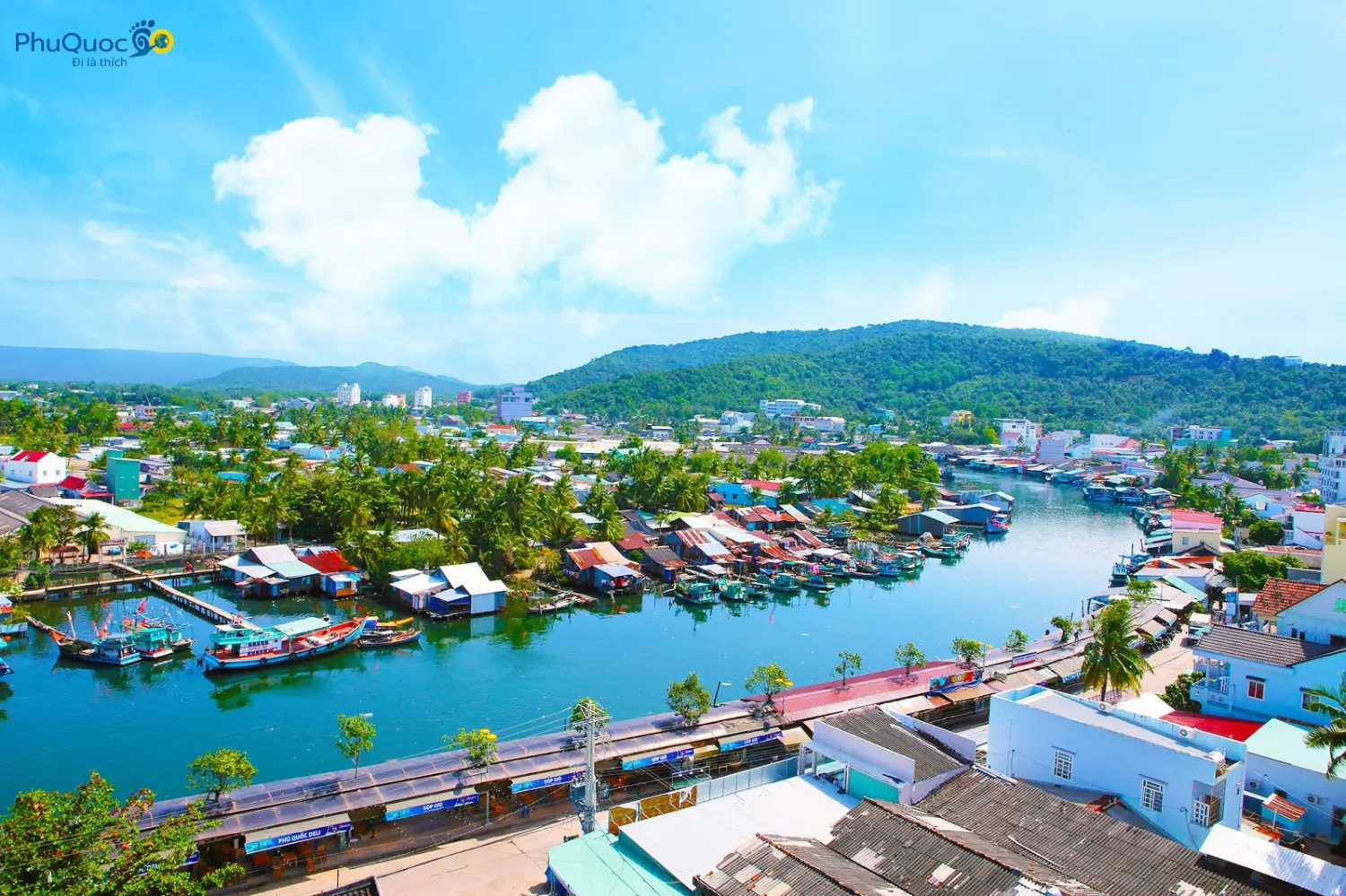
Background & Facts About the Dương Đông “Lifeblood”
Most travelers visiting the center of Dương Đông Phú Quốc pass by this river without a second thought: eating a bowl of bún quậy near the riverbank, strolling across Nguyễn Trung Trực Bridge to watch the sunset, or shopping at Chợ Dương Đông. Very few stop to find out where this river in Phú Quốc originates, how it feeds the island, and what environmental pressures it faces.
Rapid tourism infrastructure development and population growth have brought significant changes to the Dương Đông River. Understanding flow characteristics, water seasons, and suitable visiting spots will help you take control of your itinerary and avoid disappointing experiences caused by weather shifts or unregulated service traps.
1. How Long Is the Dương Đông River? Geography and Its Journey to the West Sea
Together with the Cửa Cạn River Phú Quốc, the Dương Đông River is one of the two largest and ecologically vital rivers on the island. Its total length and watercourse are reflected in these notable geographical metrics:
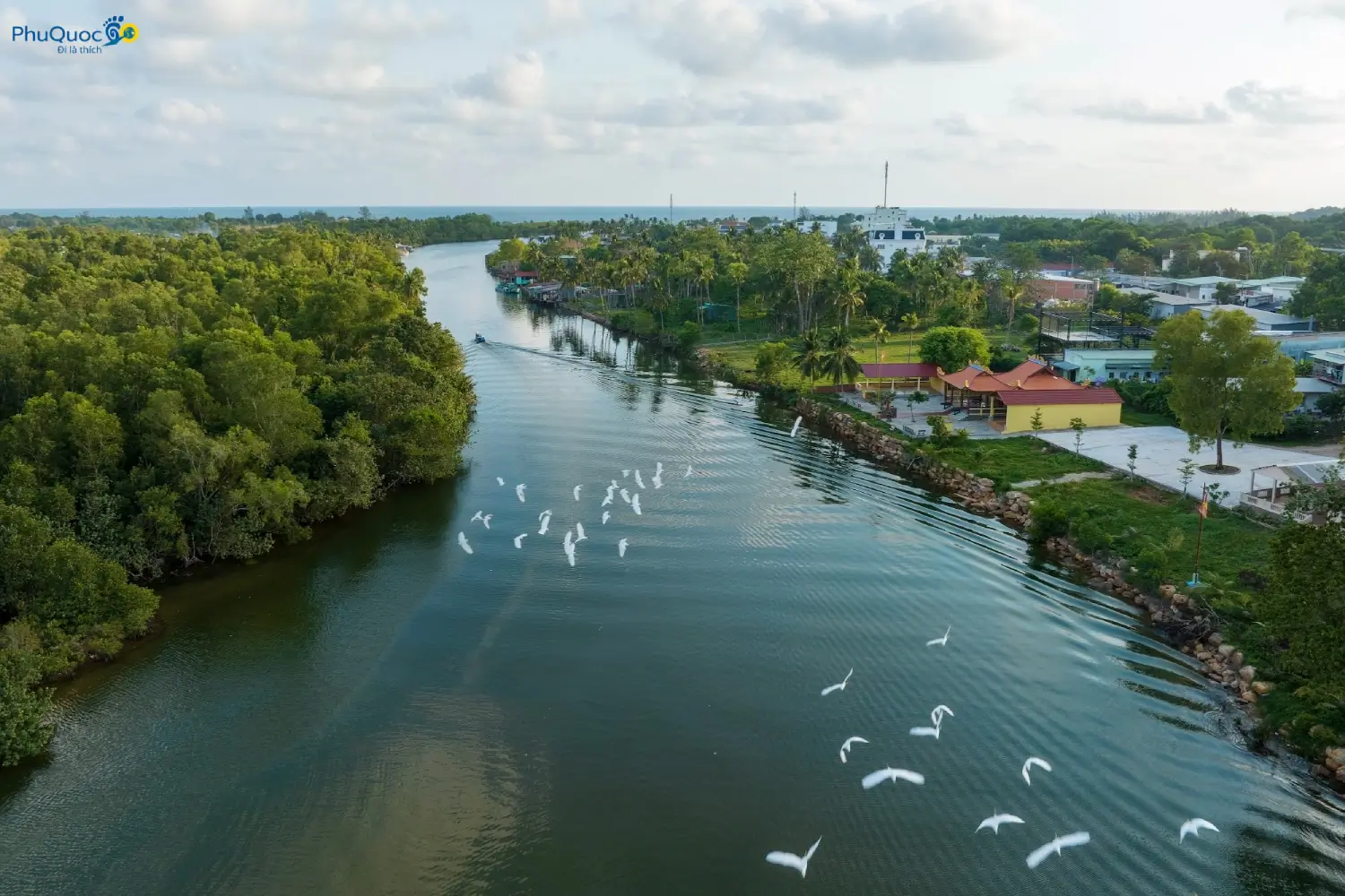
- Source & Flow Direction: The river originates from Ông Thầy Mountain (part of the Hàm Ninh Mountain Range Phú Quốc) on the east side of the island, winding east to west before emptying into the West Sea at the scenic Dinh Cậu Phú Quốc area.
- Actual Length: The main river stretches roughly 21.5 km, including about 15 km of waterway suitable for sightseeing transit. If counting the network of small streams threading through the Phú Quốc Primeval Forest, the total basin length reaches nearly 100 km.
- Challenging Terrain: A large sandbar sits right at the mouth of the Dương Đông River Phú Quốc. Moving upstream about 3 km brings deep water, after which the riverbed grows shallow and narrow. Along the route are 3 dangerous bends, numerous submerged sandbars, and a “five-way junction” area—a convergence of small creeks before splitting into 2 branches around a small, scenic islet.
The history of the Dương Đông River is closely tied to the island’s development. From a quiet fishing village along the river, it transformed into one of the major urban hubs of Kiên Giang Province.
2. Upstream Dương Đông River: Mountain Ecosystem and Precious Freshwater Source
The upper reaches of the Dương Đông River feature pristine scenery, completely detached from urban noise. It is a favored stop for those wanting to explore the island’s raw nature.
Mangrove Ecosystem and Biodiversity
Located close to the conservation zone of Phú Quốc National Park, the upstream section contains rich vegetation. Dense mangroves, mangrove apples (cây bần), Rhizophora trees (cây đước), and nipa palms line both banks, creating an ideal habitat for freshwater clams and native aquatic life.
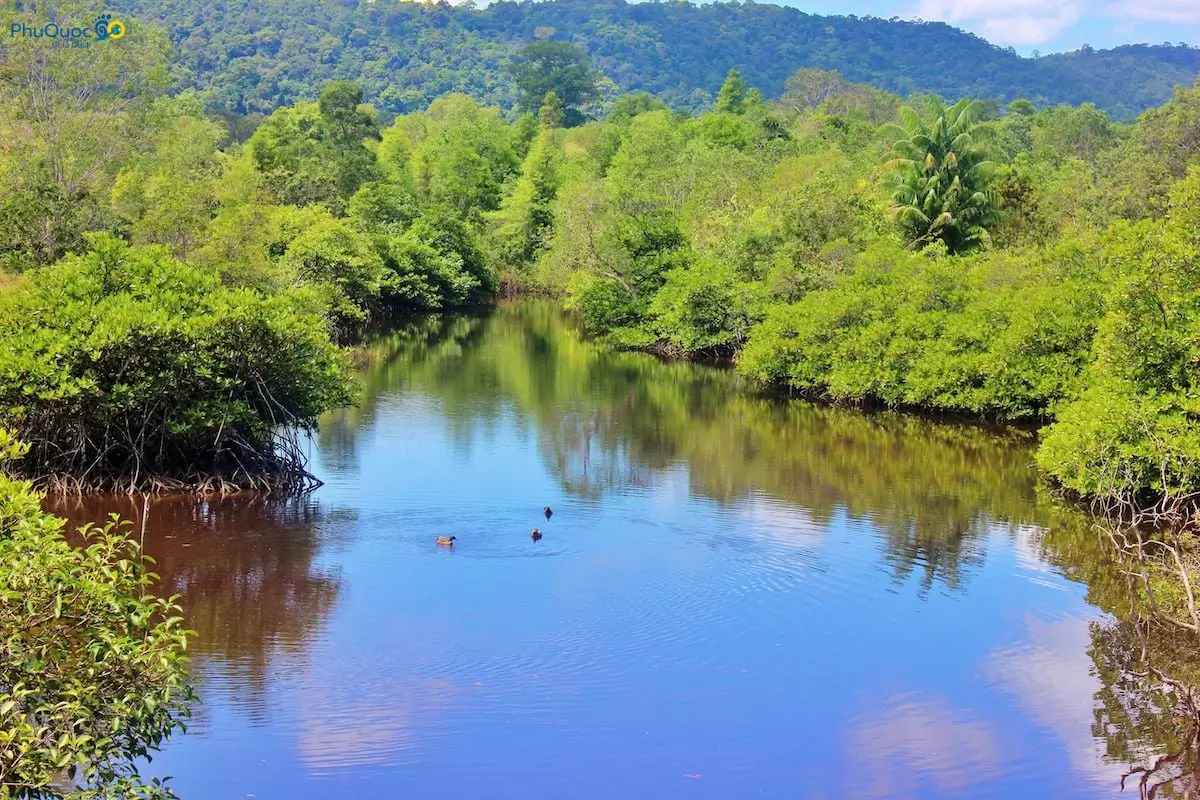
Hồ Dương Đông – The Freshwater Heart of the Island
Tucked away in the upper stream is Hồ Dương Đông, an irrigation reservoir built by the Ministry of Agriculture and Rural Development. As the island’s largest man-made freshwater reservoir, it supplies daily domestic water for the entire island city:
- Perimeter & Depth: The lake’s perimeter exceeds 3.5 km, with an average depth of 20 m.
- Capacity: Water reserves reach approximately 5.5 million m³, spread across a catchment area of roughly 16 km².
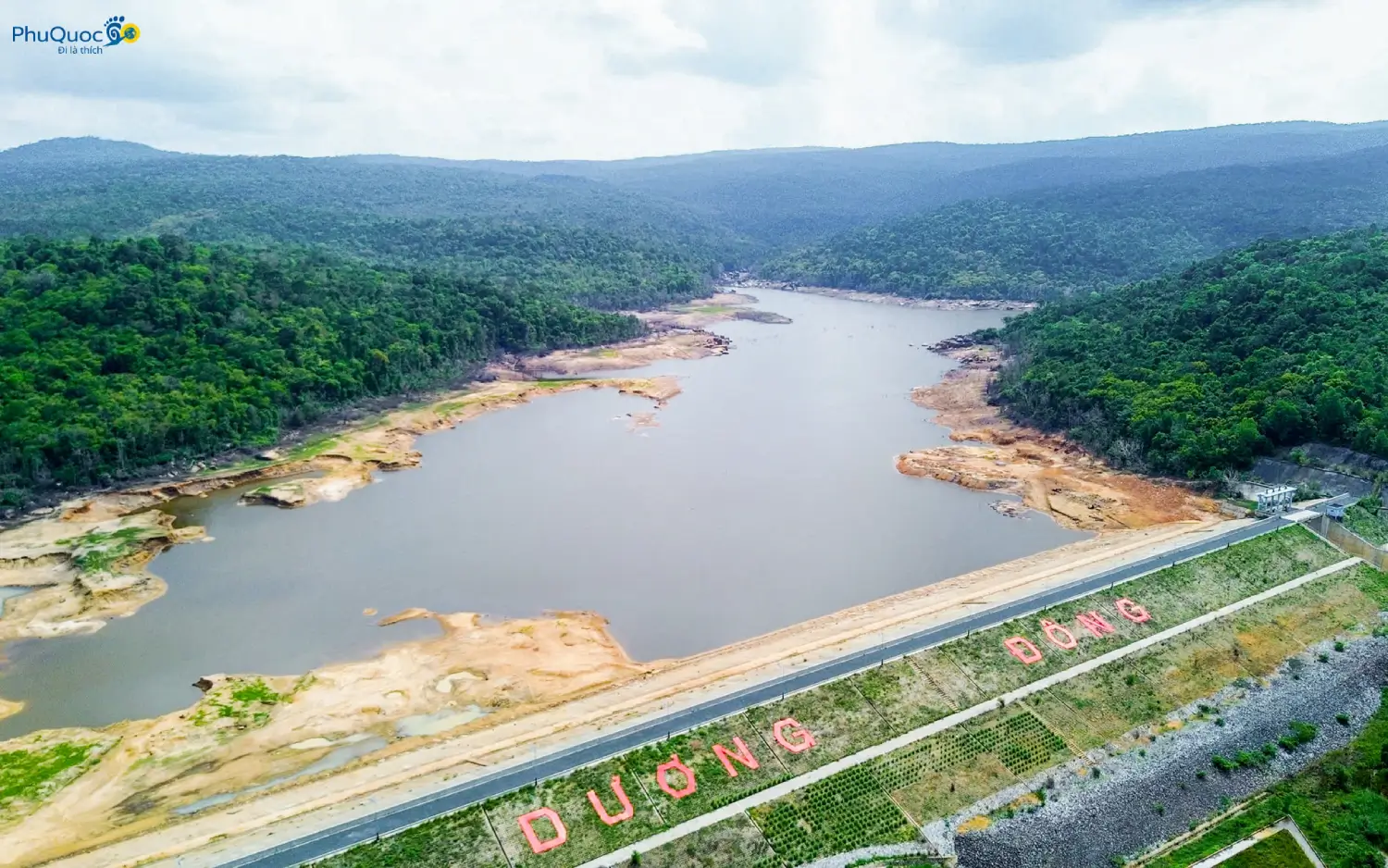
Local tip: The lake’s primary water supply comes from underground streams in the Hàm Ninh range, notably Suối Đá Ngọn Phú Quốc and Suối Đá Bàn Phú Quốc. During the rainy season (May to October), Suối Đá Ngọn features 7 roaring cascades with white foam. However, during the dry season (December to April of the following year), these streams often dry up completely, and lake water levels drop noticeably. Consider your timing carefully if planning a stream trekking trip.
3. Downstream Dương Đông River: Boat Harbor Echoes, Active Trade, and Local Cuisine
While the upper river stays tucked in the mountains, the downstream Dương Đông River displays the daily life of local coastal fishermen.
Natural Boat Harbor and Waterway Trade Center
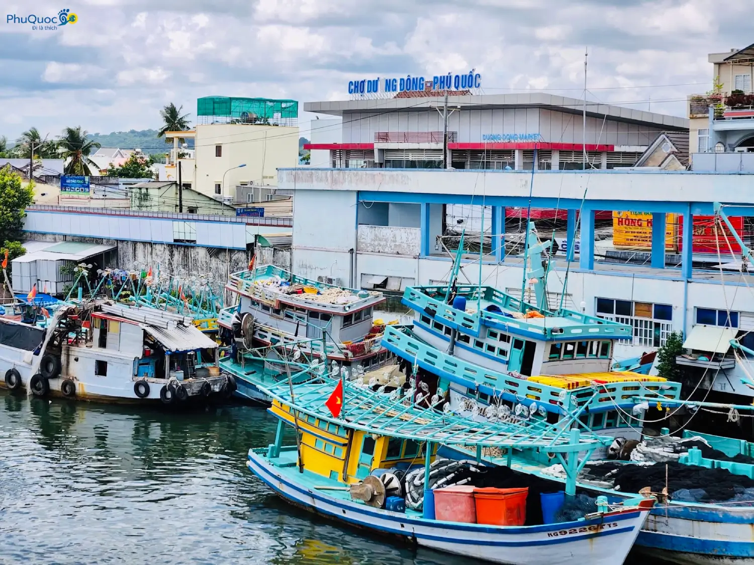
As you move toward the river mouth, the riverbed widens. Historically, the lower reach has acted as a natural shelter harbor, protecting hundreds of fishing boats during storms.
Waterway transport along the river remains a key method for delivering heavy cargo inland. Rows of anchored fishing vessels, the chug of boat engines, and ship repair yards form a distinctive local backdrop.
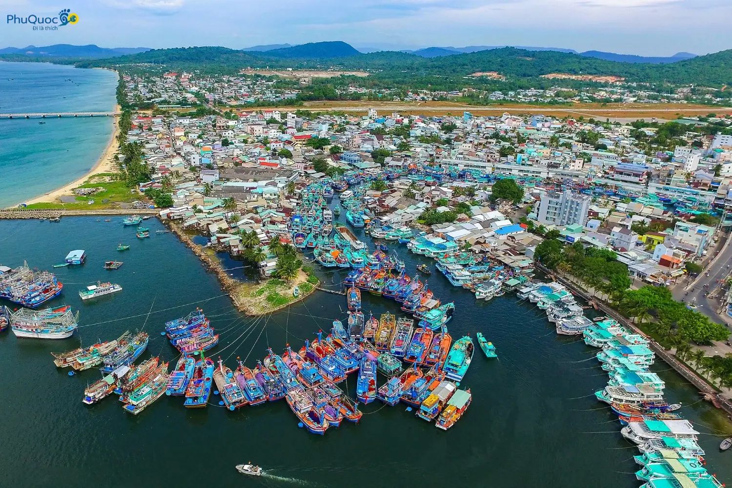
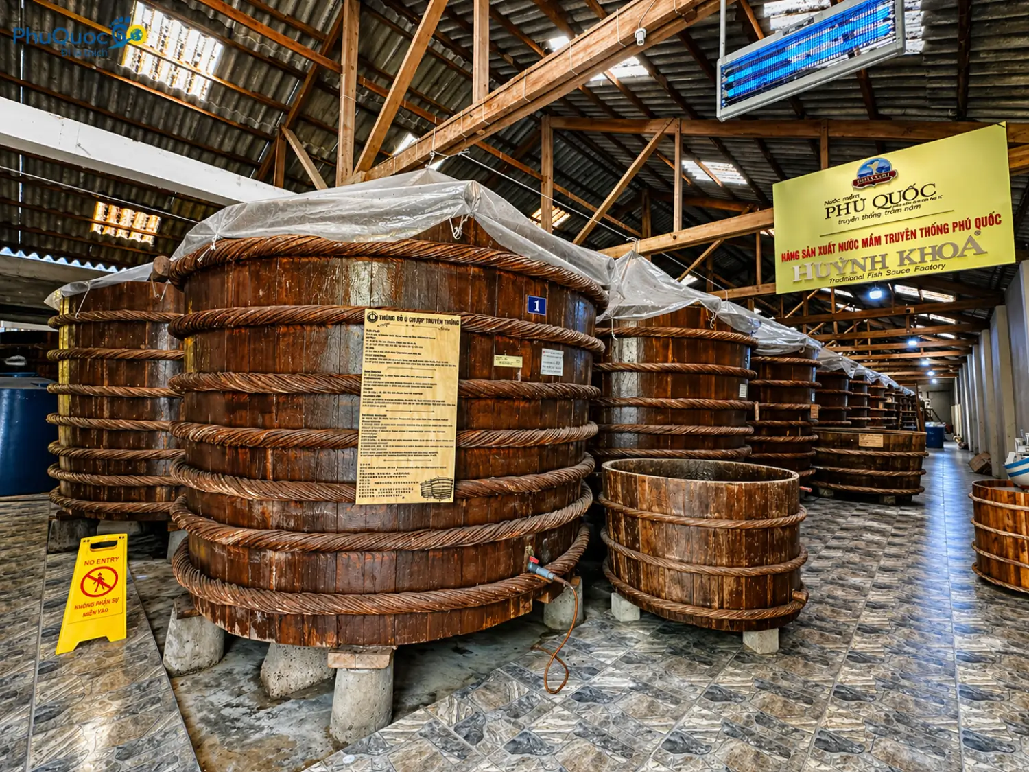
Traditional Phú Quốc fish sauce factories line both lower banks. The pungent, distinct aroma of fermenting fish sauce hanging in the air offers a striking sensory experience.
Brackish Water Zone and Distinct Food Culture
Where the Dương Đông River empties into the West Sea, high tides form a rich brackish water zone that functions as a major seafood distribution spot. Daily, returning fishing fleets bring in fresh catches, most notably herring and squid.
We recommend not missing these authentic food experiences near the lower river section:
- Gỏi cá trích Phú Quốc: Thinly sliced fresh herring mixed with sliced onion and shredded coconut, rolled in rice paper with wild herbs, and dipped in rich garlic-chili Phú Quốc fish sauce.
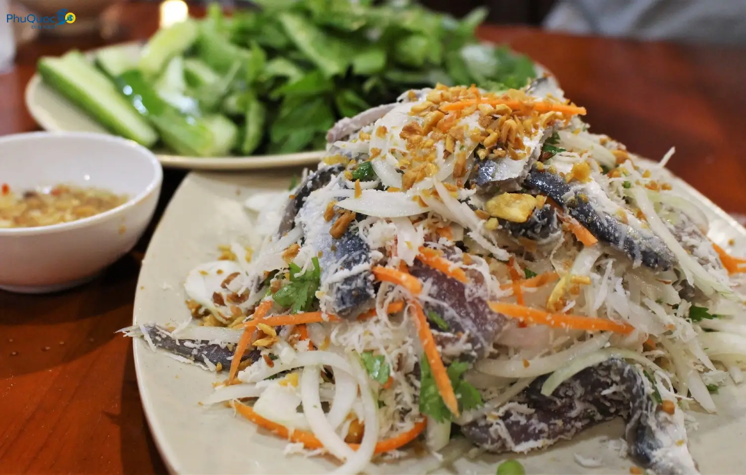
- Phú Quốc rose myrtle wine (rượu sim): Sip naturally fermented rose myrtle wine—slightly astringent and warm—to balance your palate when enjoying raw seafood.
- Evening Experience: Depart from the Dinh Cậu river mouth area to join a Phú Quốc Night Squid Fishing Tour and catch flashing squid directly from the sea.
4. Downstream Pollution Issues & Visitor Warnings
As locals on the island, we do not shy away from reality: the downstream Dương Đông River (especially sections passing through the market and residential neighborhoods) faces serious pollution issues.
Root Causes
- Dry Season Water Shortages: In the dry season, upstream stream inflow drops sharply, reducing the river’s self-cleaning capacity.
- Household Waste Discharge: Incomplete municipal wastewater collection leads to domestic wastewater and plastic waste from waterfront homes dumping directly into the river channel.
- Sludge Stirring Phenomenon: During heavy early-season rains or high tides, organic mud accumulated on the riverbed gets stirred up. The water turns dark and emits a strong odor, hurting the urban scenery.
Local Tips for a Better Trip
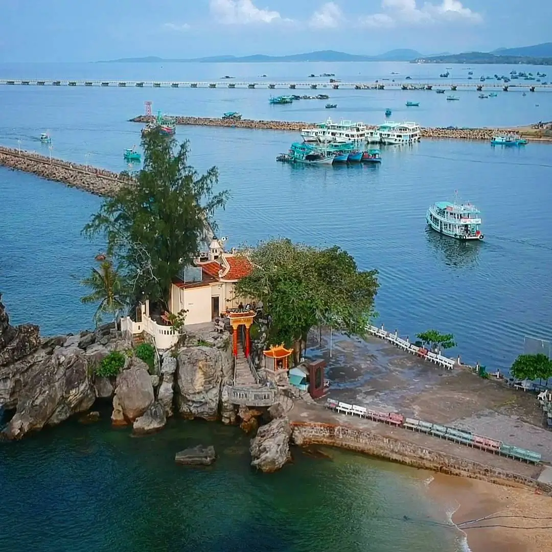
- Sightseeing Walkways: Avoid walking too close to the lower riverbanks during hot dry-season mid days or right after early-season downpours. The best spots to view the river meeting the sea are Dinh Cậu temple grounds or Nguyễn Trung Trực Bridge during cool late afternoons.
- Restaurant Selection: Pick open-air restaurants situated on higher ground or near the beach rather than spots directly on the lower water edge to ensure fresh air while dining.
Comparing the Experience: Upstream vs. Downstream Dương Đông River
| Criteria | Upstream (Streams / Hồ Dương Đông) | Downstream (River Mouth / Market / Dinh Cậu) |
| Setting & Landscape | Pristine mountain forests, narrow riverbed, mangroves, waterfalls | Active boat harbor, busy streets, river mouth meeting the sea |
| Best Time to Visit | Rainy season (May – October) when streams run full | Dry season (November – April) for scenic sunsets |
| Key Activities | Trekking, nature viewing, stream rock photography | Night market visits, fish sauce factory tours, eating gỏi cá trích |
| Pollution Level | Very clean, fresh source water | Localized pollution during dry season / early rain flushes |
| Best Suited For | Explorers, nature trekkers | First-time visitors, food & local culture lovers |
Practical Visiting Guide for the Dương Đông River
To get the most out of your visit to Dương Đông Phú Quốc, keep these practical tips in mind:
- Footwear & Gear: If trekking Suối Đá Ngọn or the upper stream, wear athletic shoes with good traction (stream rocks are mossy and slippery). Bring insect repellent for the humid mangrove zones.
- Getting Around: Rent a motorbike and ride along Nguyễn Trung Trực Street toward the reservoir. To visit the river mouth, walk 5–10 minutes from the night market center to Dinh Cậu.
- Environmental Care: Do not discard plastic trash or water bottles into the river or harbor. Help locals preserve this heritage waterway.
Conclusion & Itinerary Suggestions
The Dương Đông River is more than a geographical landmark; it is the lifeblood shaping the growth, culture, and history of Phú Quốc. While downstream pollution requires long-term solutions, the raw beauty upstream and the active harbor near the sea offer memorable experiences for island visitors.
If you want to experience the island’s rivers and coastline further, check out our kayaking guide on the Cửa Cạn River Phú Quốc or sign up for a Phú Quốc Night Squid Fishing Tour departing from the Dinh Cậu river mouth to take in the night atmosphere at sea.
FAQ – Frequently Asked Questions About Duong Dong River Phu Quoc
Can you swim in the Dương Đông River Phú Quốc?
The lower stretch running through town has heavy vessel anchorage and residential runoff, making the water unsanitary. Upstream reservoir waters serve as the island's primary drinking supply and are strictly protected against swimming. For clean natural stream swimming, visit managed sites like Suối Tranh or Suối Đá Bàn during the rainy season.
What is the best season to visit the Dương Đông River?
May to October (Rainy Season): Ideal for exploring upstream areas like Suối Đá Ngọn and Suối Đá Bàn, as streams flow strongly and foliage is lush. November to April (Dry Season): Best for walking the lower harbor area, observing trade boats, and catching sunsets at the Dinh Cậu river mouth.
Does pollution in the Dương Đông River affect activities around Dinh Cậu?
Because Dinh Cậu juts out into the West Sea with active ocean currents, nearby coastal waters stay relatively clear. However, during heavy early-season rains or high-tide sludge flushes, avoid swimming at the beach area directly adjacent to the left side of the river mouth.
Are there kayak rentals on the Dương Đông River like on the Cửa Cạn River?
The lower Dương Đông River experiences heavy traffic from large fishing vessels, creating safety hazards for small boats. The upstream section is blocked by the freshwater reservoir and restricted by narrow channels with shallow sandbars. If you want to kayak through pristine forests, the Cửa Cạn River in the north is a safer and far better option.
What should you keep in mind when eating gỏi cá trích near the lower river area?
Selecting a spot: Pick busy venues sourcing seafood directly from boats arriving that day. Eating it right: Wrap the fish with wild herbs and shredded coconut, and pair it with a small glass of rose myrtle wine (rượu sim) to prevent upset stomach from raw fish. Clarify pricing: Always confirm whether pricing is per dish or by weight before ordering to avoid peak-season surcharges.