

Phú Quốc isn’t just about blue seas, white sand, or busy entertainment centers. If you’re starting to tire of crowded tourist spots and want to find a quiet patch of untouched primary forest—where you can listen to rushing water and immerse yourself in a cool natural pool, Suoi May Waterfall Phu Quoc is the missing piece for you.
As a long-time tour operator on Pearl Island, I have seen many self-guided travelers run into trouble heading to Suối Mây: some visit during the dry season when the stream is completely bare, others get lost after losing cell service, and some fail to anticipate slippery rocks and flash floods.
In this guide, we compile the latest 2026 route details, practical trekking tips, an objective comparison with other streams, and critical safety notes so you can have a smooth trip.
Background & Why You Need to Read This Guide Before Going
Unlike heavily commercialized spots, Suối Mây hasn’t been developed into an official tourist area. There are no clear road signs, no on-duty rescue team, no Wi-Fi, and cell signal is very spotty.
A warning from a tour operator: “Never just fire up Google Maps and head straight into the Suối Mây forest without understanding the weather conditions or trail layout. Equipping yourself with local advice beforehand will help you avoid bad weather traps and unnecessary wrong turns.”
Where Is Suoi May? How Far Is It from Duong Dong Center & the Airport?
Suối Mây originates from stream crevices on the Hàm Ninh mountain range in Phú Quốc, located in Dương Tơ commune (currently part of the developing Phú Quốc special zone).
- Distance from Dương Đông ward center: About 8–10 km (around 15–20 minutes by motorbike).
- Distance from Phú Quốc Airport: Only about 5–7 km.
If you just landed on the island after traveling to Phú Quốc by plane, stopping by Suối Mây on your route toward the southern part of the island or back to town is a very convenient itinerary option.
Latest 2026 Route to Suoi May & How to Get There
1. Detailed Driving Directions
From central Dương Đông or the Phú Quốc Airport area, take main road DT47 or the Nguyễn Văn Cừ route toward Hàm Ninh Mountain.
- When you reach the Suối Mây area (Dương Tơ commune), turn onto the local residential road leading toward the base of the mountain.
- Here, you can park your bike at local homes around the mountain base for about $0.4 – $0.8 per motorbike.
- We recommend that you rent a motorbike in Phú Quốc—either a semi-automatic or a high-clearance scooter—so you can easily tackle the bumpy red-dirt roads during the rainy season.
2. Trekking Through the Forest to the Stream
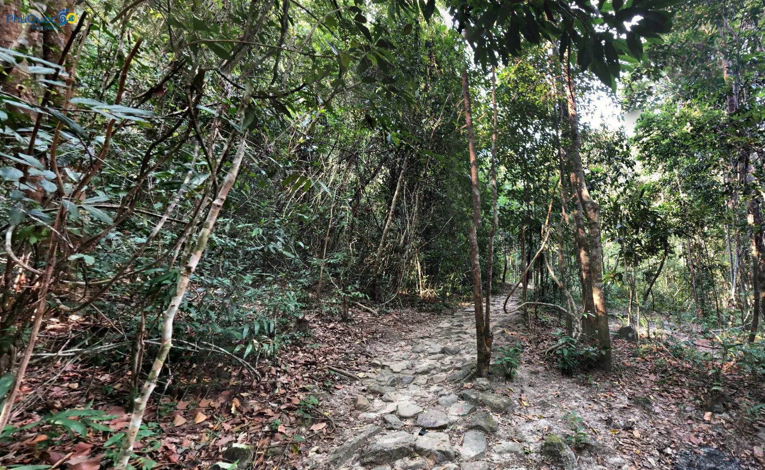
From the parking area, you begin a short Phú Quốc trekking stretch under the canopy of the Phú Quốc primary forest.
- Distance: Ranges from 1 to 2 km depending on which stream tier you want to reach.
- Hiking time: Around 20–45 minutes on foot.
- Terrain: Mostly dirt trails with exposed tree roots, slippery granite rocks, and a few mild inclines.
When Is the Best Season to Visit Suoi May? Should You Go in the Dry Season?
Timing determines 80% of Suối Mây’s beauty. Understanding Phú Quốc weather will help you pick the right moment when the stream has plenty of water and the scenery is at its best.
- Rainy season (May to October, early November): The GOLDEN window! Water rushes down abundantly from the top of Hàm Ninh, small cascades spray white foam, and the jungle air is cool and lush.
- Dry season (December to April of the following year): Water levels drop sharply; many sections dry up completely, leaving behind bare rocky beds. The scenery is unimpressive, so we don’t recommend visiting for a swim during this period.
Local tip: The ideal timing is 1–2 days after a moderate rainfall. The water is clear, the flow is gentle, it isn’t muddy, and it’s perfect for swimming.
What to Do at Suoi May? A Multisensory Jungle Experience
1. Gentle Trekking & Listening to the Rhythm of the Forest
As you venture deeper into Suối Mây, the muggy city air fades away, replaced by the earthy scent of damp soil, birds calling through the canopy, and the sound of water trickling over rocks. Ancient trees draped with hanging vines create an atmosphere reminiscent of a fairy-tale forest.
2. Swimming in Natural Pools & Soaking Away Fatigue
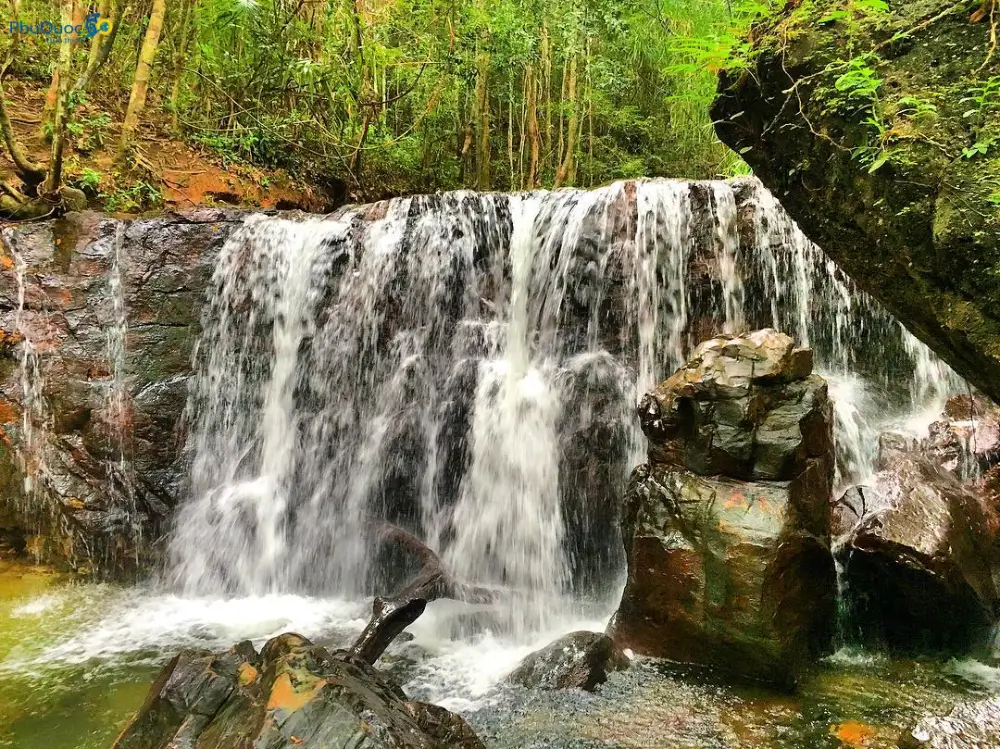
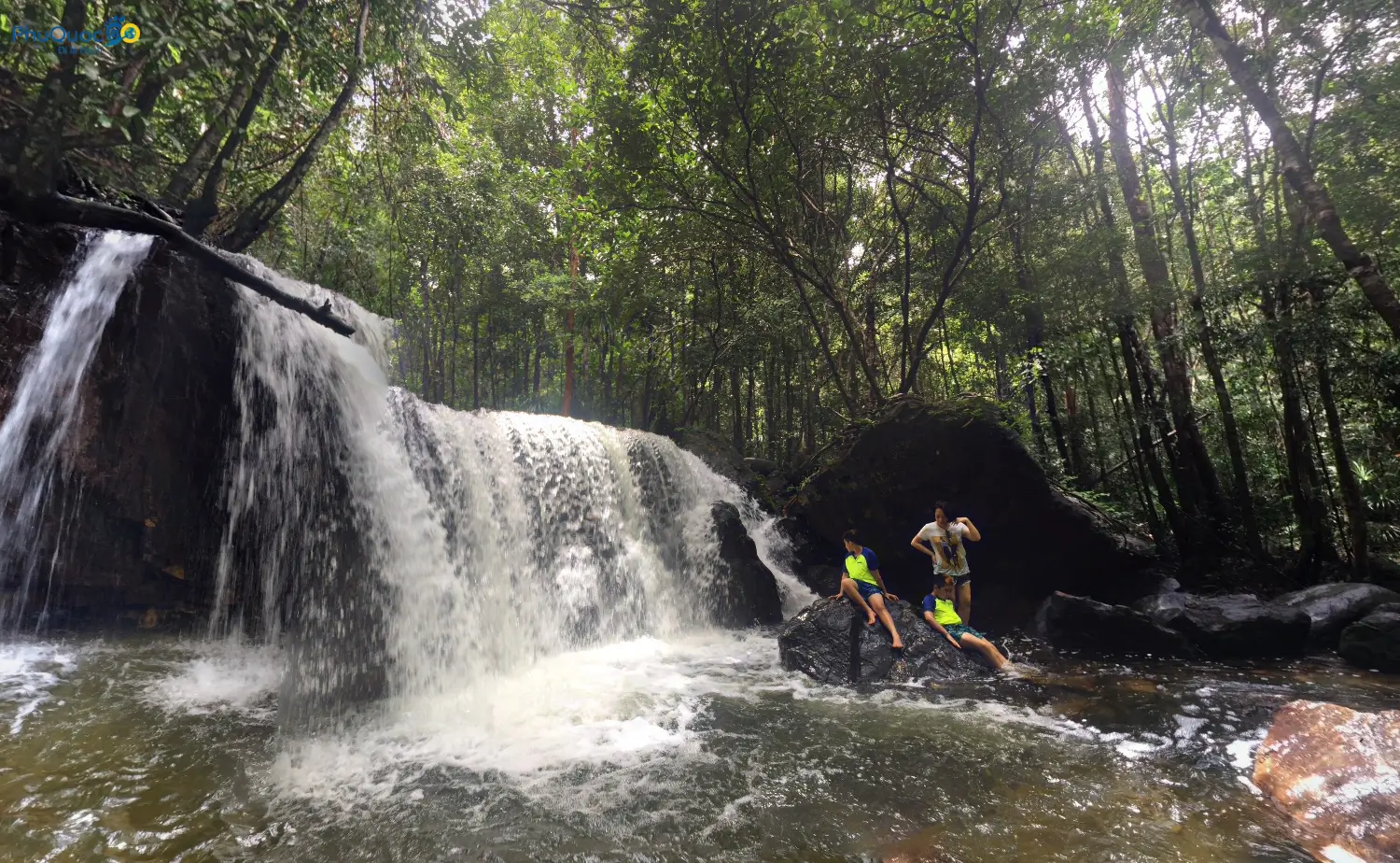
Water flowing over granite ledges forms crystal-clear natural pools. Water depth in these pools usually ranges from 0.5 to 1.5 meters, staying cool year-round. Soaking in the cool, gentle stream is the ultimate way to beat the heat.
3. Photo Ops Along the Granite Boulders
Lining the stream are large, flat granite boulders. Morning sunlight filtering through the canopy creates striking light rays—a fantastic spot for nature photography enthusiasts.
4. Picnicking & Day Camping (Remember Eco-Rules)
The flat stone slabs along the stream bank are ideal for laying out a mat, having a snack, or day camping. However, always follow the core rule: “Leave nothing behind but footprints.”.
Comparison Table: Suoi May vs. Suoi Tranh—Which Is Better?
Many travelers wonder whether they should visit Suối Mây or Suối Tranh. We’ve put together this side-by-side comparison:
| Criteria | Suối Mây Phú Quốc | Suối Tranh Phú Quốc |
| Entrance Fee | 100% Free | $0.6/person |
| Level of Development | Raw, unmanaged | Developed, commercialized |
| Facilities & Amenities | Limited (only local motorbike parking) | Full (eateries, restrooms, rest huts) |
| Crowd Levels | Quiet, uncrowded | Very crowded with tour groups |
| Nature Experience | True trekking, wild nature | Easy walking along paved stone paths |
| Waterfall Scale | Multiple small tiers & natural pools | Larger, more impressive main waterfall |
| Best Suited For | Young travelers, trekking fans, campers | Families with elderly members or young children |
Additionally, if you enjoy natural streams on the island, you can also check out Suối Đá Bàn or Suối Tiên Phú Quốc for your trip.
Packing Checklist & 5 Vital Safety Warnings
Packing Checklist
- Athletic/trekking shoes: Choose soles with good traction. Absolutely avoid flip-flops or high heels.
- Water & snacks: At least 1–2 liters of water per person plus energy bars or biscuits.
- Mosquito & leech spray: Rainy-season jungles have plenty of mosquitoes and leeches.
- Waterproof bag & power bank: Protect your phone/camera while swimming and prevent running out of battery.
- Offline Map: Pre-download offline mapping apps (like Google Maps Offline or Maps.me) since signal drops frequently in the forest.
5 Safety Warnings from Experienced Tour Operators
- Recognize early signs of FLASH FLOODS: If you see the stream water suddenly turn muddy (like coffee with milk), flow noticeably faster, carry floating debris, or if you hear a loud roaring sound from upstream on Hàm Ninh Mountain → Exit the riverbed and get to high ground immediately!
- Beware of slippery rocks: Moss-covered granite rocks in the stream bed are extremely slick. Avoid leaping from boulder to boulder.
- Watch your cell signal: Signal grows weaker the further you go. Travel in groups of 2–3 people or more, and avoid splitting up or going alone.
- Supervise children closely: If traveling with young kids, only let them play in shallow water under 0.5 meters deep, and life jackets are mandatory.
- Protect the water source: Do not litter, do not damage foliage, and never use chemical soaps or shampoos directly in the stream to prevent contaminating the ecosystem.
Conclusion & Suggested Combined Itinerary
Suối Mây Phú Quốc is an excellent choice for travelers looking for quiet surroundings and the rustic charm of the island’s nature. While modern amenities are absent, that untouched quality is precisely what appeals to independent explorers.
To streamline your routing, take a look at our 3-day 2-night Phú Quốc itinerary. You can visit Suối Mây in the morning, head over to Hàm Ninh Fishing Village at noon for fresh flower crab, and join a South Island day tour in the afternoon to catch the sunset over the sea.
We wish you a safe trip filled with memorable experiences!
Frequently Asked Questions About Suoi May Phu Quoc (FAQ)
Is there an entrance fee for Suối Mây Phú Quốc?
The only cost is motorbike or car parking managed by local residents along the trail entry. A few households sell soft drinks or rent out hammocks at modest prices.
Can you swim at Suối Mây, and is the water clean?
The stream flows directly from the primary forest on Hàm Ninh Mountain through natural granite filtration. During the rainy season (May to October), water is plentiful and forms natural pools ideal for soaking. Avoid swimming right after heavy downpours, as the water can turn muddy and swift currents present safety risks.
Is Suối Mây or Suối Tranh prettier?
If traveling with family, seniors, or young children, or if you prefer full amenities, choose Suối Tranh. If you enjoy day camping, forest trekking, and soaking in uncrowded natural stone pools, pick Suối Mây.
Is visiting Suối Mây dangerous? What should I be most careful about?
The biggest hazard is sudden flash flooding from upstream on Hàm Ninh Mountain after heavy rain. Moss-covered granite causes slips and falls, and going too deep into the forest increases the risk of getting lost. Always check the weather forecast and avoid trekking alone.
How long does trekking at Suối Mây take, and how hard is it?
The trail covers roughly 1–2 km from the parking spot. It consists mostly of dirt paths with exposed roots and mild slopes, requiring no technical trekking skills. A pair of athletic shoes with good traction is all you need.
Can children and seniors visit Suối Mây?
The trail is a natural dirt path with uneven sections and slippery rocks that can cause trips. Children should stay in shallow water under 0.5 meters and must wear life jackets. Seniors with joint issues may find Suối Tranh easier to walk through.
Can you camp and build a BBQ campfire at Suối Mây?
Flat stone slabs are great for setting up lightweight tents or picnic mats. During the dry season, never light fires due to high wildfire risks in the primary forest. Be sure to pack out all trash and food waste before leaving.
How do you spot signs of a sudden flash flood while swimming at Suối Mây?
Clear water turns yellowish-muddy or reddish-brown almost instantly. Water levels rise rapidly within minutes, carrying floating debris and leaves. If you see these signs, immediately scramble onto high granite ledges or up the forest banks on either side.